6 Drone Spots in Labuan Bajo: Check Out the Best Recommendations Here!

Fitriyawati
December 31, 2025
12 min read
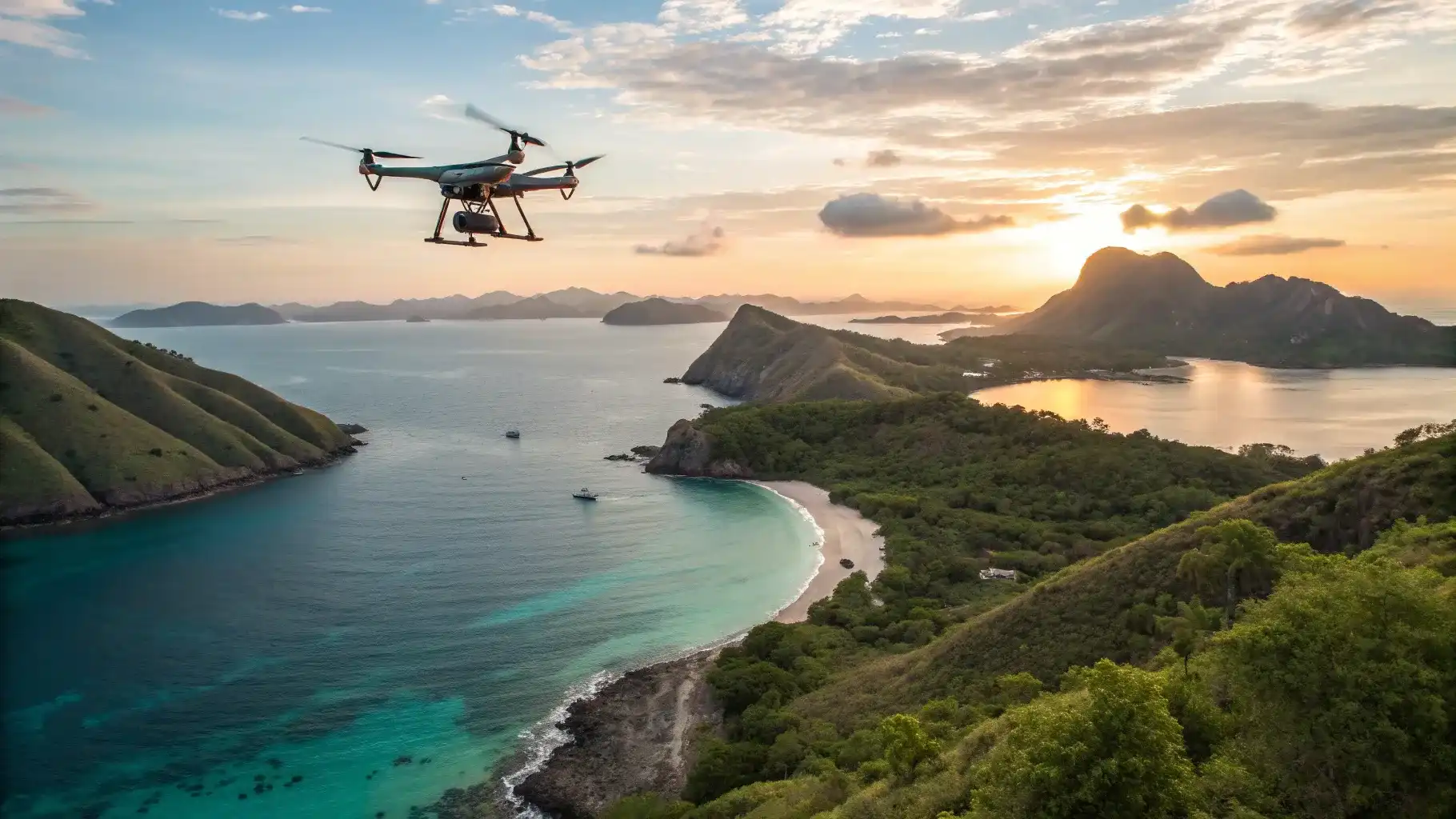
Labuan Bajo is known as one of the premium destinations in Eastern Indonesia, offering a unique and diverse natural landscape. Beyond being captivating to experience in person, this region has also become a favorite among travelers who want to capture their journey through aerial photos and videos using drones. However, can drones be flown everywhere, and how can you achieve clean, safe, and visually appealing results?
In this article, you’ll find a complete guide to drone spots in Labuan Bajo, important things to consider before flying a drone, and how professional documentation can help create more valuable and impactful travel content.
Key Takeaways
- Labuan Bajo offers a unique combination of islands, hills, waters, and traditional villages, making it a favorite drone spot for travel documentation.
- Some areas within Komodo National Park are designated no-fly zones, so it’s important to understand the restrictions before flying a drone.
- To fly in conservation areas, especially Komodo National Park, make sure you have a SIMAKSI permit and pay the Drone Operation Fee to ensure your activities are legal and safe.
- Top drone spots such as Padar Island, Pink Beach, Taka Makassar, Gili Lawa, Manjarite Island, and Wae Rebo Village offer unique aerial perspectives that can be captured professionally.
- For convenience and the best quality results, you can work with professional documentation teams like Labuan Bajo Productions or join tour packages that include documentation from IndonesiaJuara Trip.
Why Labuan Bajo Has Become a Favorite Spot for Drone Documentation?

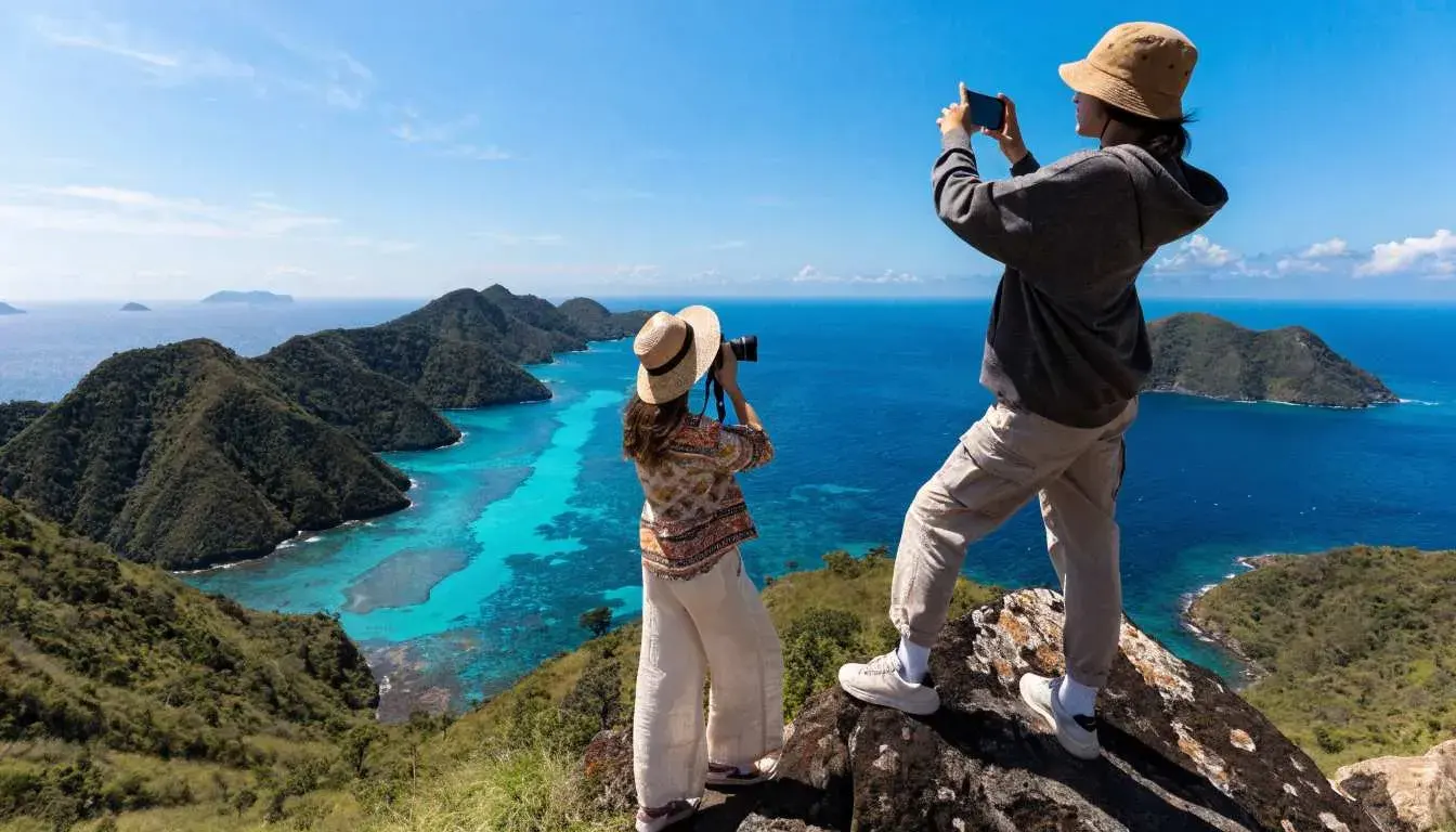
Labuan Bajo boasts a geographical advantage rarely found in other destinations. Within a single area, you can see savanna hills, small islands, shallow waters with gradient colors, and traditional villages on highlands. From the air, this combination forms visually neat patterns that are easy to interpret. Additionally, most areas in Labuan Bajo still have open spaces without high-rise buildings.
This condition allows more flexibility for drone photography in permitted areas. That’s why Labuan Bajo drone footage is often used for travel content, tourism promotion, and exclusive trip documentation. From an experiential perspective, aerial visuals provide a broader context than ground photography. You don’t just see individual objects, but also the relationships between locations, travel routes, and the overall scale of nature.
What You Need to Know Before Searching for Drone Spots in Labuan Bajo?
Before choosing drone spots in Labuan Bajo, it’s important to understand that drone use in the region isn’t entirely unrestricted. Many popular locations are within conservation areas or zones with specific rules, so knowing the regulations is crucial before attempting aerial documentation. Here are the key points to keep in mind before flying a drone in Labuan Bajo:
1. Must Have SIMAKSI and Administrative Requirements
To fly a drone in conservation areas, including areas within and around Komodo National Park, you must have a SIMAKSI (Conservation Area Entry Permit). This document serves as official authorization, ensuring drone activities are safe, do not harm the environment, and do not disturb wildlife.
SIMAKSI applications are submitted through the official website of the park management before drone activities begin. Once approved, you are also required to pay the Drone Operation Fee, which supports management, supervision, and environmental preservation within the conservation area. Without fulfilling these requirements, drone flights are considered unauthorized.
2. No-Fly Zones That Must Be Understood in Advance
Besides administrative permits, it’s important to know that not all areas in Komodo National Park allow drone flights. Some zones are designated as restricted to protect wildlife safety and environmental conservation. Key areas where drone activity is strictly prohibited include:
- Kalong Island (Rinca)
This island is home to large flying foxes (Pteropus vampyrus), which are highly sensitive to sound and light. Drones are prohibited both on land and in surrounding waters to avoid disturbing the animals’ natural behavior. - Loh Buaya Resort (Rinca Island) and Loh Liang Resort (Komodo Island)
These areas host various important bird species, including birds of prey. Since drones share the airspace with birds, flying drones here could cause disturbances, so these zones are off-limits. - Core Zone of Komodo National Park
The core zone is the main conservation area and the natural habitat of Komodo dragons. You are not allowed to enter or fly drones over this zone, as it may disturb wildlife behavior and pose safety risks.
3. Technical Challenges in the Field
Beyond regulations, the natural conditions in Labuan Bajo also present technical challenges that must be considered before flying drones. For instance, coastal winds can change rapidly, affecting flight stability, especially in open areas. Additionally, high light intensity impacts exposure settings and color quality in aerial footage. By considering these factors from the start, you can plan drone flights more effectively and ensure optimal documentation quality.
Read more: Drone Regulations & Flight Permits in Labuan Bajo & Komodo National Park
Drone Spots in Labuan Bajo
Here are some drone spots in Labuan Bajo that you can explore for travel documentation, while still adhering to the applicable rules:
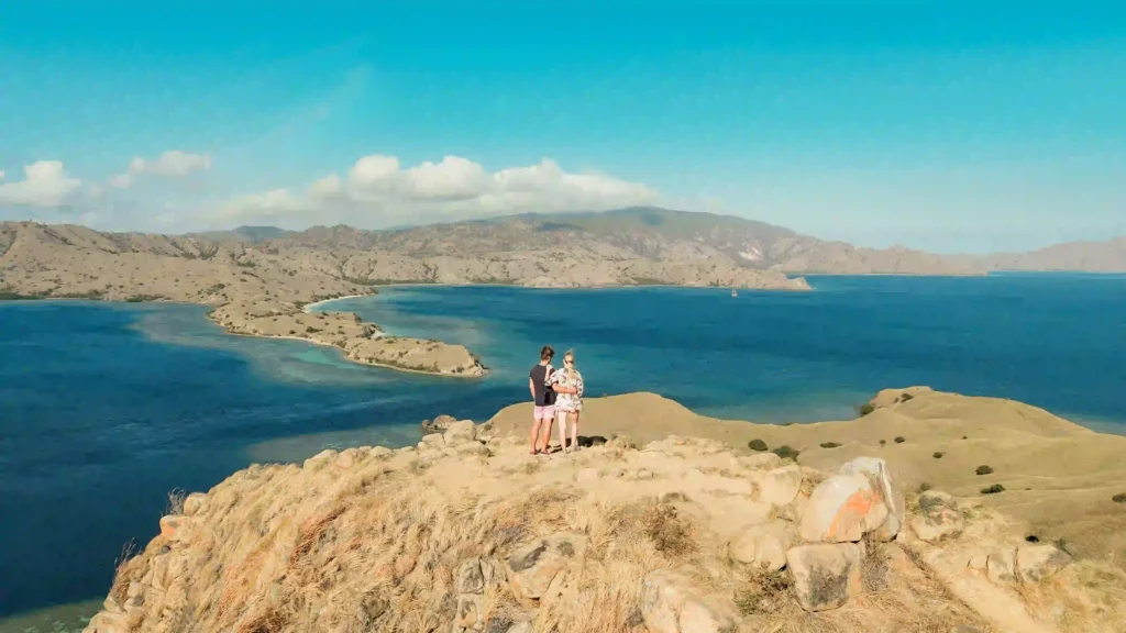
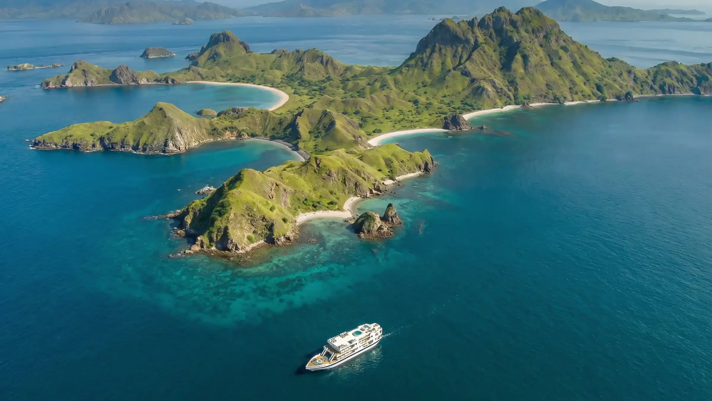
1. Padar Island
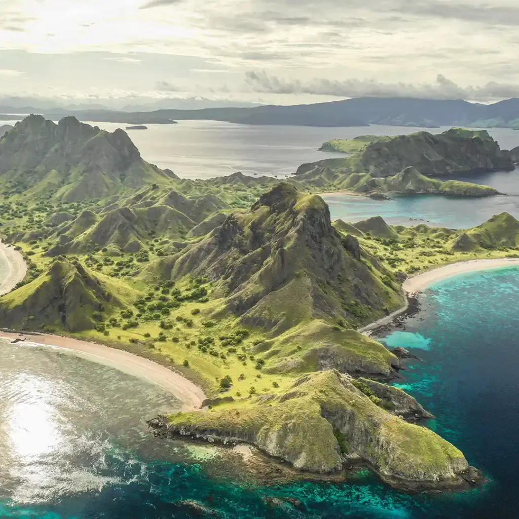
Padar Island is an ideal drone spot in Labuan Bajo for capturing the contours of hills and facing bays from the air, giving you a unique landscape perspective. However, before flying a drone here, you must ensure you have a SIMAKSI permit so that your documentation is legal and safe.
Additionally, pay attention to the direction of light and flight duration to ensure every hill curve and coastline is clearly and neatly captured. Considering these factors, drone footage from Padar Island can become a strong visual element to tell your travel story. Therefore, careful planning is essential for professional documentation that complies with conservation rules.
2. Pink Beach
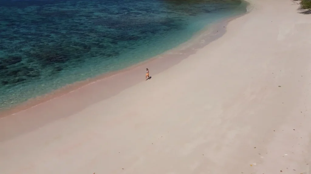
Pink Beach is one of the interesting drone spots in Labuan Bajo because you can capture the gradient of pink sand blending with the blue sea from the air, creating an aesthetically pleasing visual composition. Since it is still within Komodo National Park, you need a SIMAKSI permit before flying a drone to ensure your documentation is legal and safe.
Also, pay attention to the sun’s position and shooting angles so that the colors of the sand and water appear optimal in your footage. By considering these factors, drone footage from Pink Beach will look neat and professional. Careful planning helps you capture visual moments that truly stand out during your trip.
3. Taka Makassar
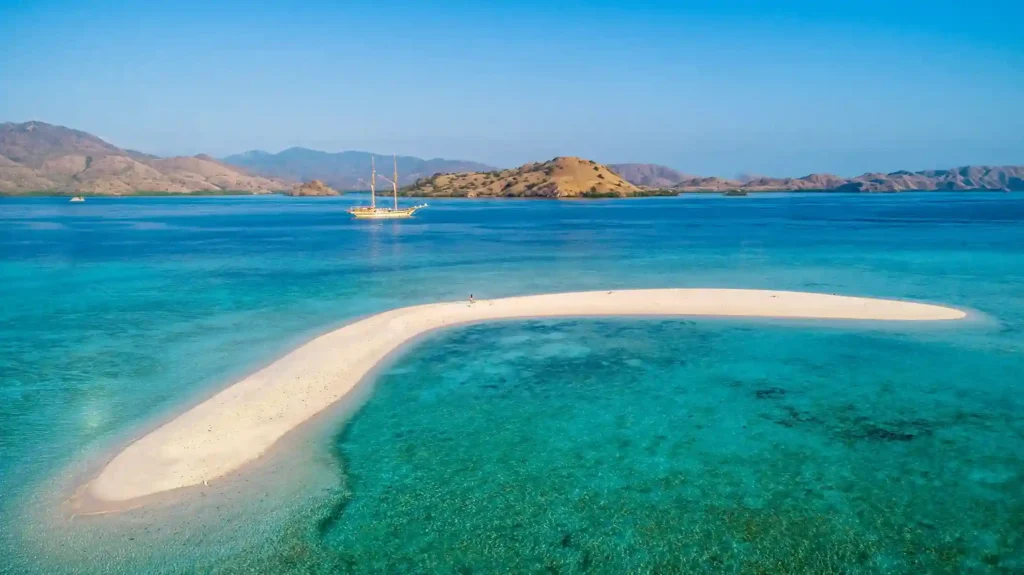
Taka Makassar is another interesting drone spot in Labuan Bajo, known for its sandbanks that appear during low tide, giving you a unique and different aerial perspective. When the water recedes, the shape of the sand island changes, surrounded by beautiful shades of blue sea, creating a captivating visual composition. You can also capture the interplay of light and shadows on the sand and water, adding dimension and depth to the footage. Drone positioning and camera angles are key to recording every detail clearly.
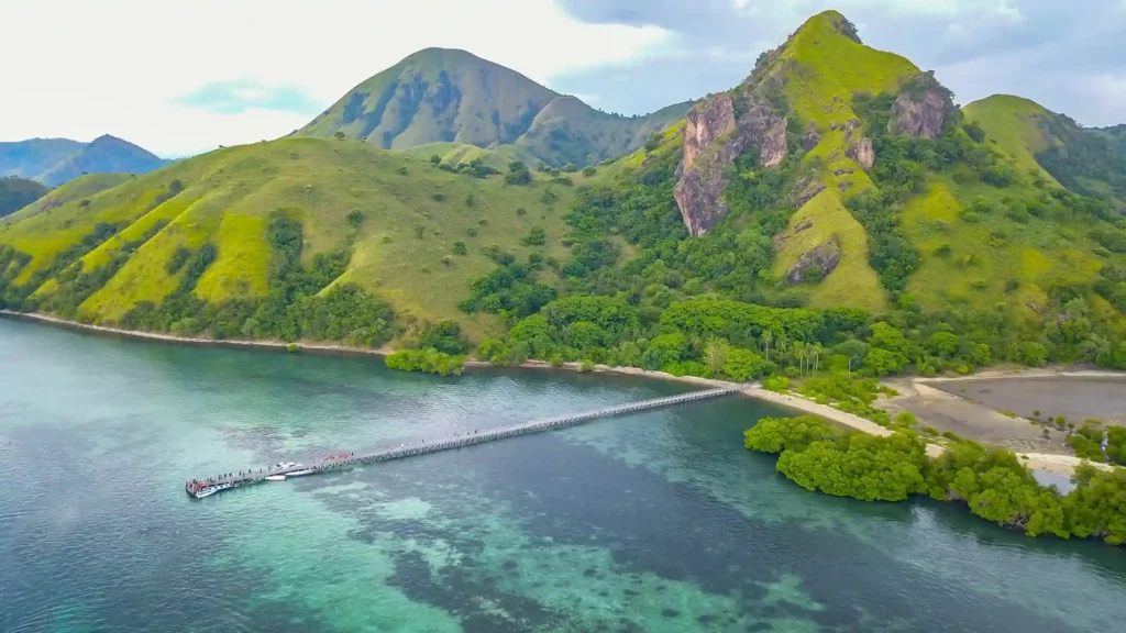
4. Gili Lawa
Gili Lawa is an attractive drone spot in Labuan Bajo because from the air you can capture the two parts of the island separated by a narrow strait in the middle, creating a distinctive and easily recognizable view from above. The formation, between Gili Lawa Darat and Gili Lawa Laut, offers an interesting landscape composition when viewed by drone, especially when morning or evening light sweeps across the coastline and hills.
Furthermore, the island’s hilltops provide a wide panorama of savanna blending with turquoise waters, making aerial footage layered and dynamic. Adjusting camera angles allows you to capture varying horizons and natural contours from different perspectives. With proper timing and angles, drone documentation at Gili Lawa can become an iconic visual in your Labuan Bajo travel story.
5. Manjarite Island
Manjarite Island is an appealing drone spot in Labuan Bajo because from the air you can see the combination of white sandy beaches and clear blue waters surrounding it, creating a beautiful color contrast for documentation. The island’s slightly elongated shape with natural curves provides an interesting visual pattern from above, giving each drone shot its own perspective.
Additionally, the shallow surrounding waters display different color gradients, adding visual depth to videos or photos. You can also capture boat activity or marine life from the air, adding context to the journey and showing human interaction with nature.
6. Wae Rebo Village
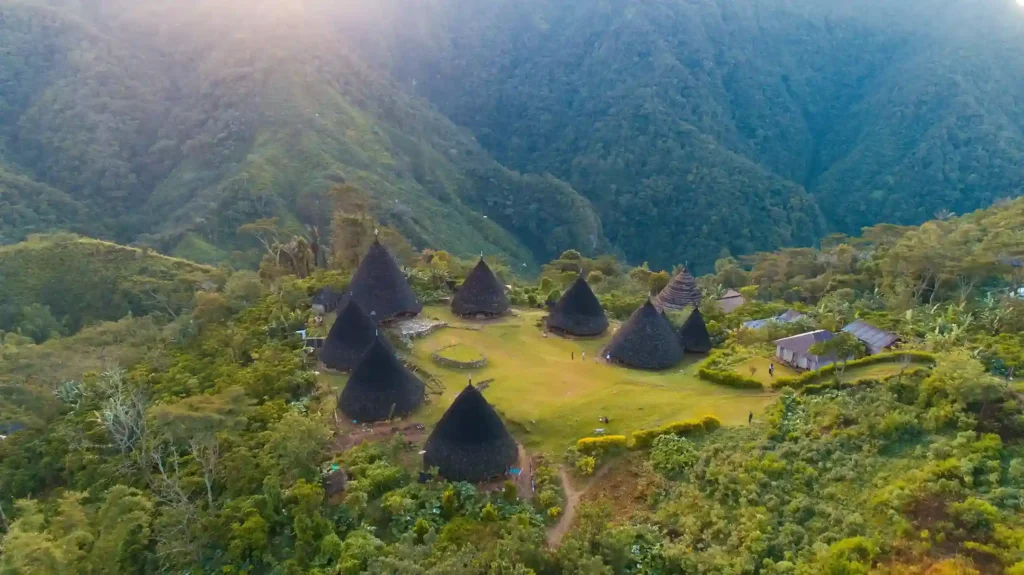
Wae Rebo Village is a fascinating drone spot in Labuan Bajo because from the air you can capture the arrangement of Mbaru Niang traditional houses, cone-shaped structures in the middle of a green valley, creating a unique perspective different from other spots. Since this location is outside Komodo National Park, you have more flexibility to choose drone angles and altitudes without strict conservation restrictions.
Moreover, the surrounding mountains and tropical forest add visual depth, making the footage rich in detail and texture. You can also use morning or evening light to emphasize the shadows of the traditional houses and the valley contours.
Read more: Photography and Videography Etiquette in Komodo National Park: Essential Things You Need to Know!
Tips for Flying Drones in Labuan Bajo
To maximize your aerial documentation, here are some important practical tips to ensure your footage looks professional and remains safe:
- Ensure the location is safe and legal
Always choose locations where drone flights are allowed. Understanding regulations and no-fly zones from the start will help you avoid problems and ensure compliance with conservation rules. - Pay attention to weather and wind conditions
Labuan Bajo has coastal winds that can change quickly. Checking the weather and selecting the right time for flight helps maintain drone stability and recording quality. - Have proper permits, especially in Komodo National Park
Before flying a drone in conservation areas, especially Komodo National Park, ensure you have SIMAKSI and follow official procedures. This is crucial for legal, safe, and non-disruptive documentation. - Set the correct altitude and angles
Choosing the right altitude and shooting angles allows you to capture landscape details and panoramas more clearly. Small perspective adjustments can make footage appear more dynamic and professional. - Consider working with professionals
If you want to focus on enjoying your trip without worrying about technical details, professional documentation teams like Labuan Bajo Productions can help capture high-quality drone footage ready to use. - Join trips with tour operators that include documentation
You can also join Labuan Bajo tour packages that provide documentation, giving you professional drone footage and photos without the hassle of managing it yourself. For example, IndonesiaJuara Trip offers tours that simultaneously document every travel moment, so you can relax while still obtaining high-quality footage.

Let’s Capture Your Labuan Bajo Vacation Moments with a Drone Together with Labuan Bajo Productions!
After exploring various drone spots in Labuan Bajo, from the hill contours of Padar Island, the gradient colors of Pink Beach, the sand island of Taka Makassar, the unique formations of Gili Lawa, the beaches and curves of Manjarite Island, to the traditional houses of Wae Rebo Village, you’ll realize that documenting every moment with a drone can be complex and requires careful planning. From understanding SIMAKSI regulations, avoiding no-fly zones, choosing the right angles and flight times, to dealing with weather conditions and drone technicalities, all aspects must be considered to ensure professional and legal footage.
For this reason, you can leave professional documentation to expert teams like Labuan Bajo Productions, who are ready to capture high-quality drone videos and photos, allowing you to enjoy your trip hassle-free. Through our Labuan Bajo Trip documentation packages, you can get complete aerial footage and travel documentation with professional shooting, neat editing, and ready-to-use results for keepsakes or promotion.
So, what are you waiting for? Book a Labuan Bajo Trip documentation package now and capture every moment of your vacation in Labuan Bajo in an easier, safer, and high-quality way!

FAQs About Drone Spots in Labuan Bajo
Can drones be flown at all spots in Labuan Bajo?
Not all locations are open for drone use because some are within conservation areas or no-fly zones. It’s important to understand the regulations and restrictions of each area before flying.
When is the best time to fly a drone in Labuan Bajo?
The best times are usually in the morning or late afternoon, as natural light is softer and the color gradients of the landscape, sea, and hills appear clearer in footage.
Are there no-fly zones for drones in Labuan Bajo?
Yes, some areas like Kalong Island, Loh Buaya Resort, Loh Liang Resort, and the Core Zone of Komodo National Park are designated as no-fly zones to ensure wildlife safety and environmental conservation.
How do I choose an ideal drone spot?
Select locations with a combination of interesting scenery, such as hills, beaches, islands, and traditional villages, which provide unique and dynamic perspectives when captured from the air.
Are all drone spots in Labuan Bajo suitable for beginners?
No, some spots like high hills or remote islands require advanced drone piloting skills. Beginners are advised to be accompanied by a professional operator.
Related Article
What Are the Benefits of Using a Professional Photographer vs Phone While on Holiday in Labuan Bajo? Find Out Here!
A holiday in Labuan Bajo always offers views that are
A holiday in Labuan Bajo always offers views that are difficult to forget. From the legendary dragons of Komodo Island

How to Document the Sunrise on Padar Island to Make it Look Engaging? Find Out Here!
If you’re planning a trip to Labuan Bajo, there’s a
If you’re planning a trip to Labuan Bajo, there’s a good chance Padar Island is already on your itinerary. This
Through the Lens: The Best Ultra-Luxury Superyacht in Komodo National Park
LABUAN BAJO, INDONESIA — Labuan Bajo Productions, as a production
LABUAN BAJO, INDONESIA — Labuan Bajo Productions, as a production house experienced in creating content for the most exclusive yachts